Corey Houk (@2khoukwx) 's Twitter Profile
Corey Houk

@2khoukwx

99.9 The Big Dawg WVLC

ID: 904249322

calendar_today25-10-2012 16:44:57

17,17K Tweet

1,1K Followers

769 Following

Zero Meter Chasers (@0meterchasers) 's Twitter Profile Photo

Here’s your Saturday 7/12 Bowling Green KY Forecast. Shower chances increase today but a higher coverage for Sunday as a weak Front slides in. The front won’t cool us down a bit, as temps warm back up by middle of next week with more shower chances as a Ridge builds into the

Here’s your Saturday 7/12 Bowling Green KY Forecast.

Shower chances increase today but a higher coverage for Sunday as a weak Front slides in. The front won’t cool us down a bit, as temps warm back up by middle of next week with more shower chances as a Ridge builds into the
Zero Meter Chasers (@0meterchasers) 's Twitter Profile Photo

7/12/25 SPC states that storm coverage will increase this afternoon, with instances of damaging winds possible. They state that there is a 40% chance a watch is issued across the highlighted area. We are on standby for updates and live coverage if needed! -Corey

7/12/25
SPC states that storm coverage will increase this afternoon, with instances of damaging winds possible. They state that there is a 40% chance a watch is issued across the highlighted area. We are on standby for updates and live coverage if needed! -Corey
Corey Houk (@2khoukwx) 's Twitter Profile Photo

Strong storms to effect positions of Central Kentucky through 6 PM EDT Winds up to 50 MPH, brief heavy rain, and lightning are the main threats!

Strong storms to effect positions of Central Kentucky through 6 PM EDT 
Winds up to 50 MPH, brief heavy rain, and lightning are the main threats!
Will Hodges (@willhod89856982) 's Twitter Profile Photo

Mr. Dragon, Larry Judd, receiving a jacket back in 2023 for 48+ years of service. He served Green County Schools for about 50 years. He was a friend to all! He loved our kids, he loved our community! Rest in peace friend, Heaven is now your home!

Mr. Dragon, Larry Judd, receiving a jacket back in 2023 for 48+ years of service. He served Green County Schools for about 50 years.

He was a friend to all!  He loved our kids, he loved our community!

Rest in peace friend, Heaven is now your home!
Zero Meter Chasers (@0meterchasers) 's Twitter Profile Photo

7/13/25 WPC states that scattered areas of Flash Flooding will be possible this evening across the highlighted area. Our team is on standby, ready to provide coverage if needed. -Corey

7/13/25
WPC states that scattered areas of Flash Flooding will be possible this evening across the highlighted area. 
Our team is on standby, ready to provide coverage if needed. -Corey
Corey Houk (@2khoukwx) 's Twitter Profile Photo

7/15/25 Scattered showers and thunderstorms are expected this morning and again this afternoon and evening. Torrential rainfall, gusty winds, and lightning will be the main threats with the strongest storms.

7/15/25
Scattered showers and thunderstorms are expected this morning and again this afternoon and evening. Torrential rainfall, gusty winds, and lightning will be the main threats with the strongest storms.
Corey Houk (@2khoukwx) 's Twitter Profile Photo

7/17/25 Scattered showers and thunderstorms are expected this afternoon and evening. Some of the storms could be severe, characterized by strong, gusty winds, torrential rainfall, and intense lightning. The WPC has also placed the entire state in a slight risk (yellow) for

7/17/25
Scattered showers and thunderstorms are expected this afternoon and evening. Some of the storms could be severe, characterized by strong, gusty winds, torrential rainfall, and intense lightning.
The WPC has also placed the entire state in a slight risk (yellow) for
I-65 Weather (Kentucky) (@i65wxsils) 's Twitter Profile Photo

SATURDAY FORECAST: An MCS is forecasted to punch through the Cornbelt today and looks to deflate as it approaches the River late this evening. Some isol’d showers ahead of it will be likely this late Afternoon/Early evening but Damaging 💨 & a brief 🌪️ can’t rule out along MCS.

Corey Houk (@2khoukwx) 's Twitter Profile Photo

7/19/25 Scattered storms are likely again today. Not everyone will see storms, but any storm that develops will be capable of gusty winds, lightning, and torrential rainfall. The WPC has placed the entire state in a slight risk for excessive rainfall, which means scattered

7/19/25 
Scattered storms are likely again today. Not everyone will see storms, but any storm that develops will be capable of gusty winds, lightning, and torrential rainfall. 
The WPC has placed the entire state in a slight risk for excessive rainfall, which means scattered
Corey Houk (@2khoukwx) 's Twitter Profile Photo

7/19/25 The WPC has upgraded portions of Western and Central Kentucky into a MODERATE risk for excessive rainfall, which means numerous instances of flash flooding are likely! If you live in areas with poor drainage, are flood-prone, and are located in a low-lying area, and

7/19/25 

The WPC has upgraded portions of Western and Central Kentucky into a MODERATE risk for excessive rainfall, which means numerous instances of flash flooding are likely! 
If you live in areas with poor drainage, are flood-prone, and are located in a low-lying area, and
Corey Houk (@2khoukwx) 's Twitter Profile Photo

EXTREME HEAT Expected today! •Heat Advisory (Orange) is in effect. Heat Index values as high as 108 •Excessive Heat Warning (Purple) Heat index values as high as 110 Hot temperatures and high humidity may cause heat illnesses

EXTREME HEAT Expected today!
•Heat Advisory (Orange) is in effect. Heat Index values as high as 108
•Excessive Heat Warning (Purple) Heat index values as high as 110
Hot temperatures and high humidity may cause heat illnesses
Corey Houk (@2khoukwx) 's Twitter Profile Photo

7/22/25 DENSE FOG Advisory in effect through 8 AM CDT/ 9 AM EDT for counties in the blue If driving, slow down, use your low-beam headlights, and leave plenty of distance ahead of you.

7/22/25
DENSE FOG Advisory in effect through 8 AM CDT/ 9 AM EDT for counties in the blue
If driving, slow down, use your low-beam headlights, and leave
plenty of distance ahead of you.
Corey Houk (@2khoukwx) 's Twitter Profile Photo

Heat Indices will reach into the upper 90s to near 107 today. Heat advisory is in effect for the counties in the orange. Extreme Heat Warning is in effect for the counties in the purple

Heat Indices will reach into the upper 90s to near 107 today. 
Heat advisory is in effect for the counties in the orange.
Extreme Heat Warning is in effect for the counties in the purple
Corey Houk (@2khoukwx) 's Twitter Profile Photo

7/27/25 It's going to be another blazing hot week, but help is on the way! The latest temperature outlook suggests a 40% chance of below-average temperatures beginning on Friday. High Temperatures on Friday, Saturday, and Sunday will range from the upper 70s to the lower 80s.

7/27/25
It's going to be another blazing hot week, but help is on the way! The latest temperature outlook suggests a 40% chance of below-average temperatures beginning on Friday. 
High Temperatures on Friday, Saturday, and Sunday will range from the upper 70s to the lower 80s.
Zero Meter Chasers (@0meterchasers) 's Twitter Profile Photo

CAN NOT express how much our Broadcaster Corey Houk does for me when I do my daily forecasts and 7-Day. He does a phenomenal job and appreciate his work! I honestly forgot to send my info in to him last night after a long day so he could make my 7-Day. But there’s lot of data 📈
Adam Schefter (@adamschefter) 's Twitter Profile Photo

Breaking: Savion Hiter (Savion “Cinco” Hiter (High-ter)), regarded by many as the No. 1-rated RB in the Class of 2026, has committed to the University of Michigan, per his advisor @coachmccannert.

Breaking: Savion Hiter (<a href="/5starsavi/">Savion “Cinco” Hiter (High-ter)</a>), regarded by many as the No. 1-rated RB in the Class of 2026, has committed to the University of Michigan, per his advisor @coachmccannert.
Jeffery Thompson (@thefifthky) 's Twitter Profile Photo

Corey Houk checked the skies—81° at kickoff, sliding into the 70s late. That’s what we call prime time football weather. #5THFBL x #MakeItMatter
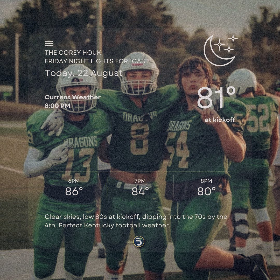
<a href="/2kHoukWx/">Corey Houk</a> checked the skies—81° at kickoff, sliding into the 70s late. That’s what we call prime time football weather.

#5THFBL x #MakeItMatter