Nelson Tucker (@tornadostudy) 's Twitter Profile
Nelson Tucker

@tornadostudy

A main researcher, writer, admin at @tornado_talk. Millersville Meteorology 2026. NIST SURF 2024. Skywarn Spotter, CWS Lead. Preisdent of @project_otus.

ID: 934153742747922432

linkhttps://www.theotusproject.com/ calendar_today24-11-2017 20:16:22

10,10K Tweet

701 Takipçi

441 Takip Edilen

OTUS Project (@project_otus) 's Twitter Profile Photo

An UPDATE on the State of OTUS Project Data Science: This spring, the OTUS Project collected incredible measurements inside eight tornadoes on over a dozen flights. While we have shared previews of our data and even provided raw numbers to several academic researchers in

Josh Morgerman (@icyclone) 's Twitter Profile Photo

Small taste of #Hurricane #MELISSA on SW coast of #Jamaica, just as we started getting raked by violent right eyewall. Belive it or not, this was before the peak conditions, when everything turned white, the screaming sound became unbearable, & we needed to bolt the door shut.

WeatherNation (@weathernation) 's Twitter Profile Photo

NEW VIDEO: Our field correspondent Josh Morgerman (Josh Morgerman) is in Black River, Jamaica, one of the hardest hit locations by Hurricane Melissa. Here's some of the damage he's seeing. 🔽🔽 #Melissa

AccuWeather (@accuweather) 's Twitter Profile Photo

Drone footage reveals the devastation in Lacovia, Jamaica, where Hurricane Melissa left homes in ruins, roads underwater, and power knocked out across the region.

Josh Morgerman (@icyclone) 's Twitter Profile Photo

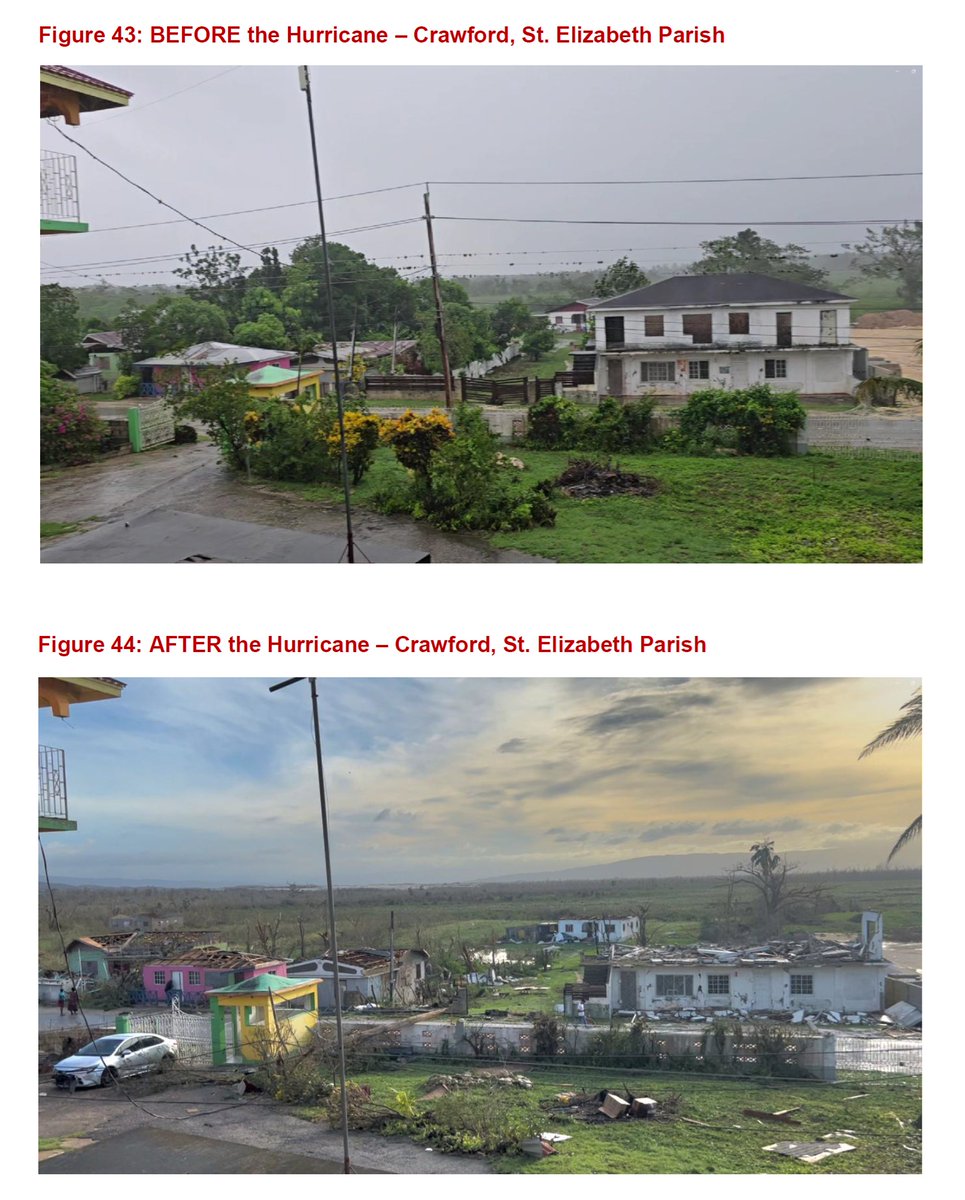
I listened to so many inspiring tales of survival in Crawford #Jamaica today. The common threat: everyday people doing their best in an insane situation: the core of Cat-5 #Hurricane #MELISSA. * Keith ("Benji") Carey survived the storm surge in a tiny cement building on the

I listened to so many inspiring tales of survival in Crawford #Jamaica today. The common threat: everyday people doing their best in an insane situation: the core of Cat-5 #Hurricane #MELISSA. 

* Keith ("Benji") Carey survived the storm surge in a tiny cement building on the
ABC News (@abc) 's Twitter Profile Photo

Drone footage reveals the catastrophic aftermath of Hurricane Melissa on Jamaica’s western coast, where entire communities have been either demolished or isolated. Read more: abcnews.link/ucYyDCd

NOAA's Ocean Service (@noaaocean) 's Twitter Profile Photo

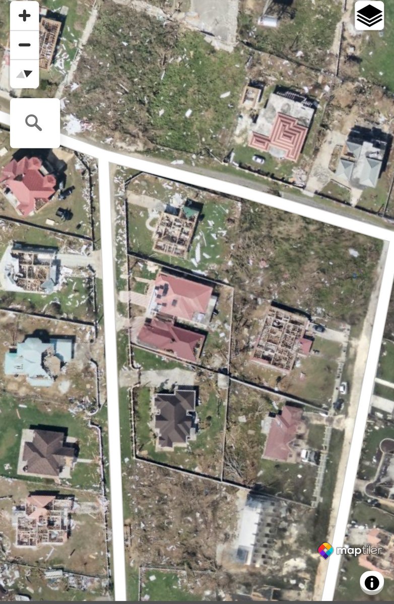
NOAA is flying over over the area affected by Hurricane Melissa to support disaster response efforts in Jamaica. Find all the available imagery in our viewer: storms.ngs.noaa.gov/storms/melissa…

NOAA is flying over over the area affected by Hurricane Melissa to support disaster response efforts in Jamaica. Find all the available imagery in our viewer: storms.ngs.noaa.gov/storms/melissa…
Nelson Tucker (@tornadostudy) 's Twitter Profile Photo

Remarkable to see such a vast area of ~EF2-3 level wind damage. Certainly not the intensity of a violent tornado, but at a far greater scale. Some hurricane proofed vacation homes destroyed, but there’s a noticeable difference in level of destruction (Black River comparison)

Remarkable to see such a vast area of ~EF2-3 level wind damage. Certainly not the intensity of a violent tornado, but at a far greater scale. Some hurricane proofed vacation homes destroyed, but there’s a noticeable difference in level of destruction (Black River comparison)
Josh Morgerman (@icyclone) 's Twitter Profile Photo

Want to honor this noble tree. It withstood the wrath of Cat-5 #Hurricane #MELISSA's inner-core winds. As the screaming white void swallowed up the town & started tearing the hotel apart, the tree danced & twisted obscenely. But it held on. Never gave up. I'm so in love with it.

Want to honor this noble tree. It withstood the wrath of Cat-5 #Hurricane #MELISSA's inner-core winds. As the screaming white void swallowed up the town & started tearing the hotel apart, the tree danced & twisted obscenely. But it held on. Never gave up. I'm so in love with it.
Tomer Burg (@burgwx) 's Twitter Profile Photo

Swing… and a (huge) miss Be careful with interpreting AI model run-to-run consistency as a sign of high confidence & likelihood — FNV3 was insistent on exceptional rapid deepening up to the last minute when it failed to materialize:

Swing… and a (huge) miss

Be careful with interpreting AI model run-to-run consistency as a sign of high confidence & likelihood — FNV3 was insistent on exceptional rapid deepening up to the last minute when it failed to materialize:
Nelson Tucker (@tornadostudy) 's Twitter Profile Photo

Wonderful to be at the Mid Atlantic Severe Weather Conference this year with my Tornado Talk friends - always uplifting to see how our field is being utilized for good purposes and see familiar faces.

Wonderful to be at the Mid Atlantic Severe Weather Conference this year with my Tornado Talk friends - always uplifting to see how our field is being utilized for good purposes and see familiar faces.
Vincent Ledvina (@vincent_ledvina) 's Twitter Profile Photo

If you missed the northern lights tonight, there is still a shot for Wednesday night as we are anticipating another solar storm to arrive around Nov 12 midday UT, or in the coming hours. This is from the X5.1 solar flare which launched a large CME towards Earth yesterday. This

If you missed the northern lights tonight, there is still a shot for Wednesday night as we are anticipating another solar storm to arrive around Nov 12 midday UT, or in the coming hours. This is from the X5.1 solar flare which launched a large CME towards Earth yesterday.

This
NOAA Space Weather Prediction Center (@nwsswpc) 's Twitter Profile Photo

WATCH: Geomagnetic Storm Category G4 or Greater Predicted Highest Storm Level Predicted by Day: Nov 13: G4 (Severe) Nov 14: G1 (Minor) Nov 15: None (Below G1) Issue Time: 2025 Nov 12 1805 UTC bit.ly/3wVgAKH

PREVOTS (@prevots_svr) 's Twitter Profile Photo

| Atualização sobre os tornados de 7/11 | O tornado de Candói–Guarapuava, PR, foi elevado para F4. A primeira imagem mostra o mapa atualizado com os tornados identificados até agora, com a inclusão das trilhas de danos de Dionísio Cerqueira – SC e do norte do PR. (1/n)

| Atualização sobre os tornados de 7/11 |

O tornado de Candói–Guarapuava, PR, foi elevado para F4.

A primeira imagem mostra o mapa atualizado com os tornados identificados até agora, com a inclusão das trilhas de danos de Dionísio Cerqueira – SC e do norte do PR. (1/n)
Weather Monitor (@weathermonitors) 's Twitter Profile Photo

The dramatic advance of a glowing pyroclastic flow from Mount Semeru was captured today by AfarTv’s live webcam. 📍East Java, Indonesia.

Josh Morgerman (@icyclone) 's Twitter Profile Photo

Just released FINAL version of my #MELISSA report. Has 2 new sections: 1) RADAR TRACK & ANALYSIS has detailed landfall track & diagrams based on exhaustive frame-by-frame analysis of radar imagery; 2) DAMAGE has over 75 pics! Link in comments. My only focus now: the video!

Just released FINAL version of my #MELISSA report. Has 2 new sections: 1) RADAR TRACK & ANALYSIS has detailed landfall track & diagrams based on exhaustive frame-by-frame analysis of radar imagery; 2) DAMAGE has over 75 pics! Link in comments. My only focus now: the video!
NASA Mars (@nasamars) 's Twitter Profile Photo

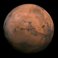
Our Perseverance rover has recorded the sounds of electrical sparks and mini-sonic booms in dust devils on Mars. 🌪️⚡️ Long theorized, the phenomenon has now been confirmed through audio and electromagnetic recordings captured by the rover. Listen in: go.nasa.gov/4ow4612