Patrick Ebel(@PWJEbel) 's Twitter Profile Photo

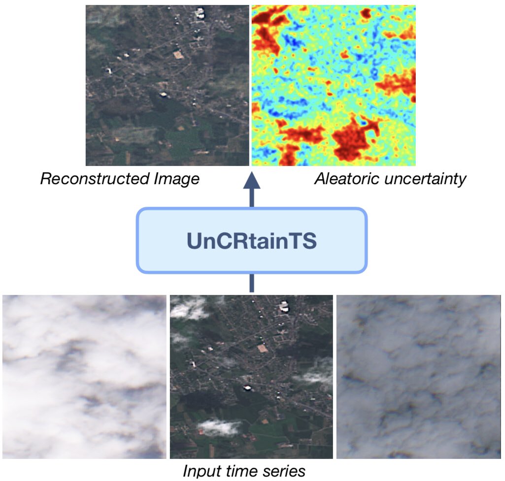
We’re excited to announce that our work “UnCRtainTS: Uncertainty Quantification for Cloud Removal in Optical Satellite Time Series” has been accepted at this year’s #CVPR2024 EarthVision ! i/iii

We’re excited to announce that our work “UnCRtainTS: Uncertainty Quantification for Cloud Removal in Optical Satellite Time Series” has been accepted at this year’s @CVPR @EarthVisionWS ! i/iii
account_circle
Sudipan Saha(@sudipansaha) 's Twitter Profile Photo

Change predictions based on my and Patrick Ebel 's method in Mariupol over the last month, which subsequently would require ground truth confirmations. This may be areas impacted by explosion, but also other changes. Note that the method does not use any post-event optical image.
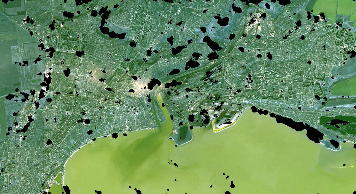
Change predictions based on my and @PWJEbel 's method in Mariupol over the last month, which subsequently would require ground truth confirmations.  This may be areas impacted by explosion, but also other changes. Note that the method does not use any post-event optical image.
account_circle
Patrick Ebel(@PWJEbel) 's Twitter Profile Photo

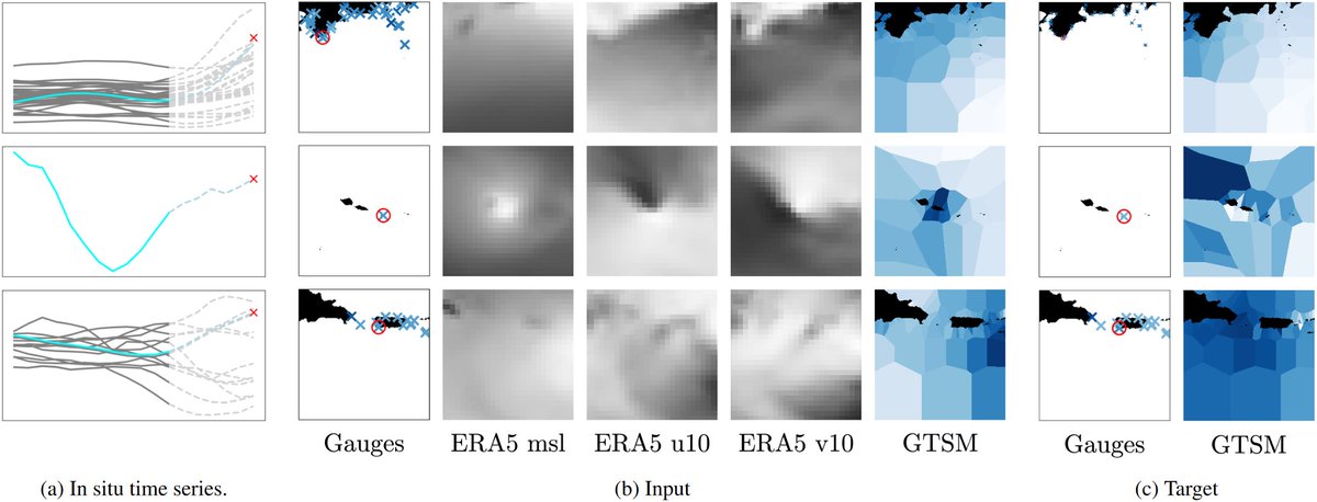
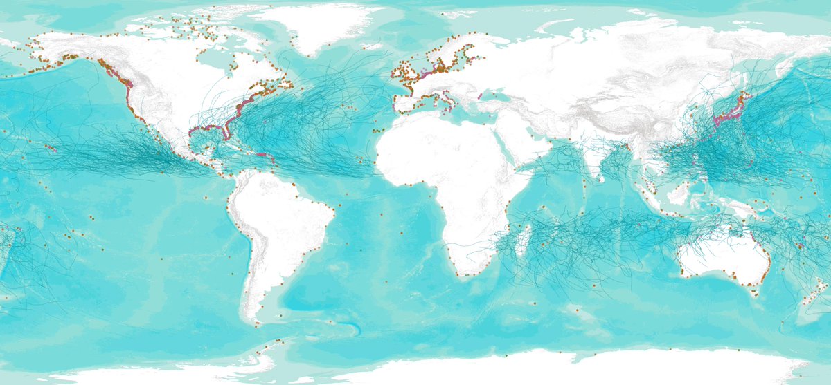
In our paper, we curate a global and multi-decadal dataset of paired in-situ tide gage data, atmospheric reanalysis and ocean state simulations to enable training and benchmarking of deep neural networks.

In our paper, we curate a global and multi-decadal dataset of paired in-situ tide gage data, atmospheric reanalysis and ocean state simulations to enable training and benchmarking of deep neural networks.
account_circle
Patrick Ebel(@PWJEbel) 's Twitter Profile Photo

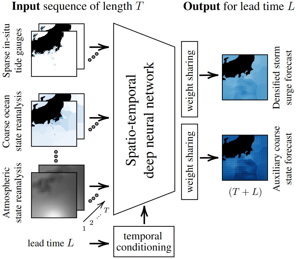
The challenge we tackle is that of combining the accuracy of sparse in-situ data with the dense coverage of global atmosphere and ocean state products. While the latter are available worldwide, in-situ infrastructure is often limited for communities most at risk of such hazards.

The challenge we tackle is that of combining the accuracy of sparse in-situ data with the dense coverage of global atmosphere and ocean state products. While the latter are available worldwide, in-situ infrastructure is often limited for communities most at risk of such hazards.
account_circle
Patrick Ebel(@PWJEbel) 's Twitter Profile Photo

Our approach aims to densify sparsely deployed but precise in-situ measurements on a global scale. This is accomplished by e.g. broadcasting forecasts from gauged to ungauged sites, input data dropout and auxiliary supervision.

Our approach aims to densify sparsely deployed but precise in-situ measurements on a global scale. This is accomplished by e.g. broadcasting forecasts from gauged to ungauged sites, input data dropout and auxiliary supervision.
account_circle
Patrick Ebel(@PWJEbel) 's Twitter Profile Photo

Curious how clouds affect remote sensing applications, such as land cover classification? Jakob Gawlikowski, Michael Schmitt at UniBw M, Xiaoxiang ZHU and me provide an analysis and interpretation of the effects of cloud coverage!

Check out ieeexplore.ieee.org/document/99568…
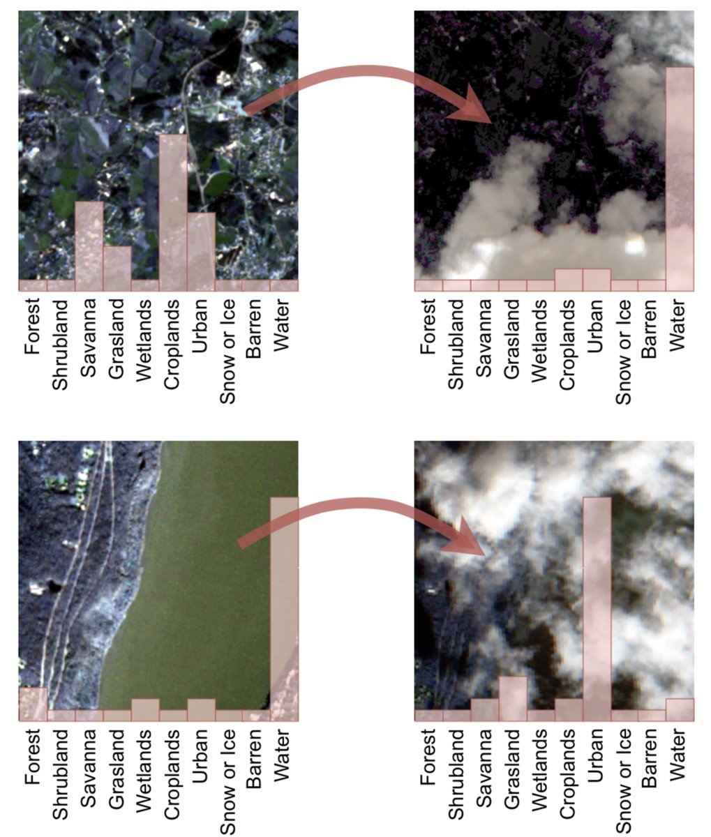
Curious how clouds affect remote sensing applications, such as land cover classification? @gawlikowskij, Michael Schmitt at @unibw_m, @xiaoxiang_zhu and me provide an analysis and interpretation of the effects of cloud coverage! 

Check out ieeexplore.ieee.org/document/99568…
account_circle
Patrick Ebel(@PWJEbel) 's Twitter Profile Photo

Everyone, please check out our latest work on global forecasting of storm surges at ungauged locations, accepted at #CVPR2024 EarthVision 2024! arxiv.org/abs/2404.05758 @ESA ESA Earth Observation

Everyone, please check out our latest work on global forecasting of storm surges at ungauged locations, accepted at @CVPR @EarthVisionWS 2024! arxiv.org/abs/2404.05758 @ESA @ESA_EO #Philab
account_circle
Xiaoxiang ZHU(@xiaoxiang_zhu) 's Twitter Profile Photo

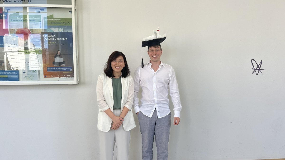
Exciting news: Dr. Ebel Patrick Ebel has successfully defended his PhD on in . Congrats, Patrick! 🎉 In my view, he did significant contributions towards and cloud removal in satellite images for real world applications.

Exciting news: Dr. Ebel @PWJEbel has successfully defended his PhD on #cloudremoval in #AI4EO. Congrats, Patrick! 🎉 In my view, he did significant contributions towards #trustworthy and #scalable cloud removal in satellite images for real world applications.
account_circle
Patrick Ebel(@PWJEbel) 's Twitter Profile Photo

We‘re organizing the joint ESA-ECMWF workshop in Frascati next year. Come and join us! Submissions are now open.

account_circle
Sudipan Saha(@sudipansaha) 's Twitter Profile Photo

I and Patrick Ebel stressed the importance of change detection systems that can work without post-change optical data (e.g., ieeexplore.ieee.org/document/95383…). Ukraine crisis further confirms it, there is hardly any cloud-free optical S2 image there so far.

account_circle
Patrick Ebel(@PWJEbel) 's Twitter Profile Photo

on a related matter, also see our Master student Ziqi’s work on “Explicit Haze & Cloud Removal for Global Land Cover Classification” presented earlier this year sites.google.com/view/rainfores…

account_circle
Patrick Ebel(@PWJEbel) 's Twitter Profile Photo

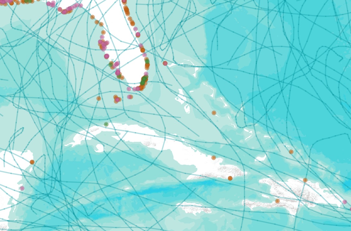
Storm surges are a major hazard in the context of cyclone impact and land subsidence, which are prognosed to become more problematic due to climate change and rising sea levels.

account_circle
Patrick Ebel(@PWJEbel) 's Twitter Profile Photo

UnCRtainTS combines cloud removal in optical satellites with pixel-wise uncertainty predictions. In practice, it can be used to control for reconstruction quality. You can find the preprint at arxiv.org/abs/2304.05464 iii/iii

account_circle
Mikolaj Czerkawski(@mikonvergence) 's Twitter Profile Photo

Patrick Ebel Robin Cole Thank you for the kind words Patrick Ebel - also, those interested in cloud removal problems should definitely check out Patrick’s excellent works like DSen2-CR, GLF-CR (among many others) as well as their related datasets!
account_circle