Lisa Villegas(@WxVillegas) 's Twitter Profileg
Lisa Villegas

@WxVillegas

Certified Broadcast Meteorologist⚡️ Vegan for the planet 🌱 🌎 ✌🏼

ID:303446686

linkhttp://www.facebook.com/wxlisavillegas calendar_today22-05-2011 21:50:26

17,8K Tweets

12,1K Followers

958 Following

Eric Garlick(@EricGarlickwx) 's Twitter Profile Photo

A cloudy start to the day with a few areas of light rain possible. This will give way to some dry time and even some sunshine later this afternoon and evening. Nice weather to start the week. wx

account_circle
Eric Garlick(@EricGarlickwx) 's Twitter Profile Photo

⛈️First Alert: Scattered to widespread storms will be moving through the area this afternoon and evening.
Heavy rain and damaging winds will be the main threats, but some hail is possible. wx

account_circle
Eric Garlick(@EricGarlickwx) 's Twitter Profile Photo

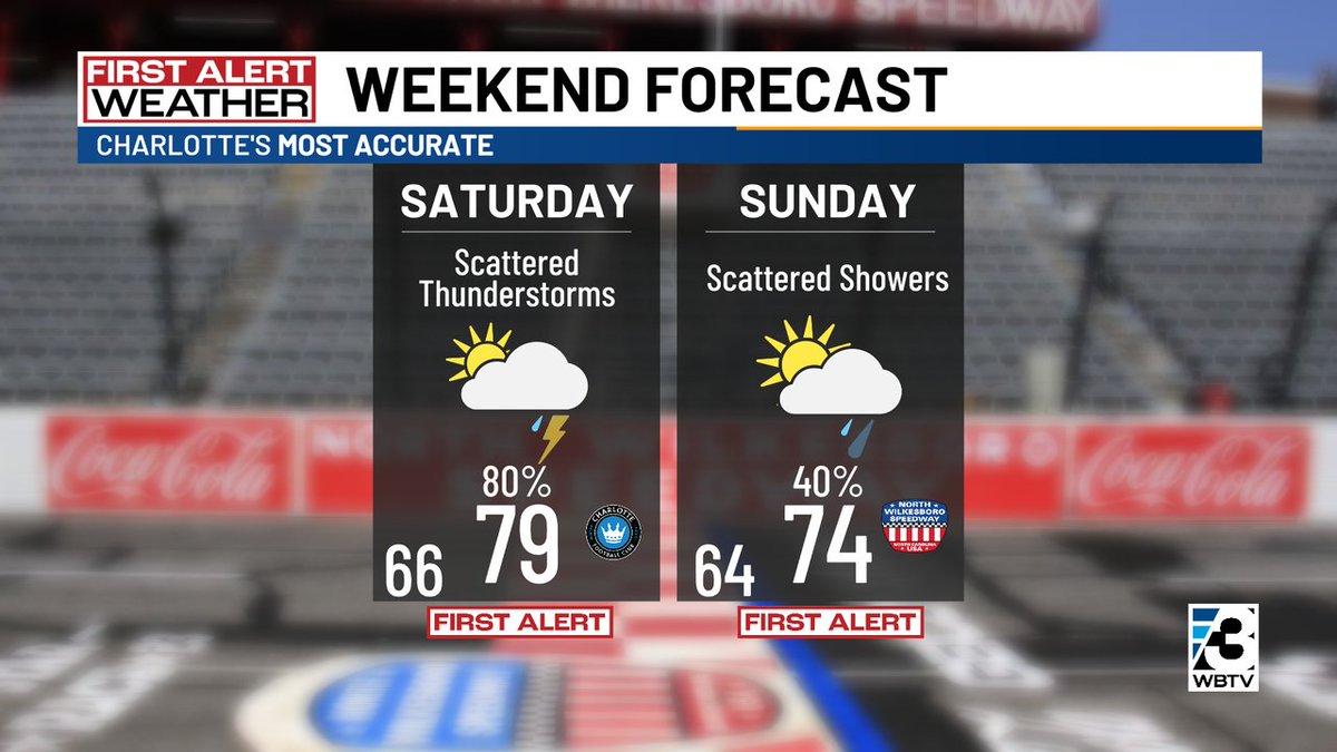
⛈️First Alert: Here is a look at the latest timeline for storm chances.
Scattered thunderstorms will be possible Friday Evening, best chances Saturday afternoon/evening. Storm chances will linger into Sunday. wx

account_circle
Al Conklin WBTV(@AlConklin) 's Twitter Profile Photo

First Alerts are out for & the @wbtv_news are both weekend days, but Saturday looks to be - by far - the more active wet weather day. Most of Sunday's rain could be very early on & if we get enough afternoon sunshine we could wind up in the upper 70s. wx

First Alerts are out for #CLT & the @wbtv_news are both weekend days, but Saturday looks to be - by far - the more active wet weather day. Most of Sunday's rain could be very early on & if we get enough afternoon sunshine we could wind up in the upper 70s. #NCwx #SCwx #CLTwx
account_circle
Eric Garlick(@EricGarlickwx) 's Twitter Profile Photo

⛈️First alerts remain in place for Friday and Saturday. Scattered thunderstorms will be likely.
Friday T'Storm chances will pick up through the afternoon/evening with better storm chances for Saturday. wx

account_circle
Al Conklin WBTV(@AlConklin) 's Twitter Profile Photo

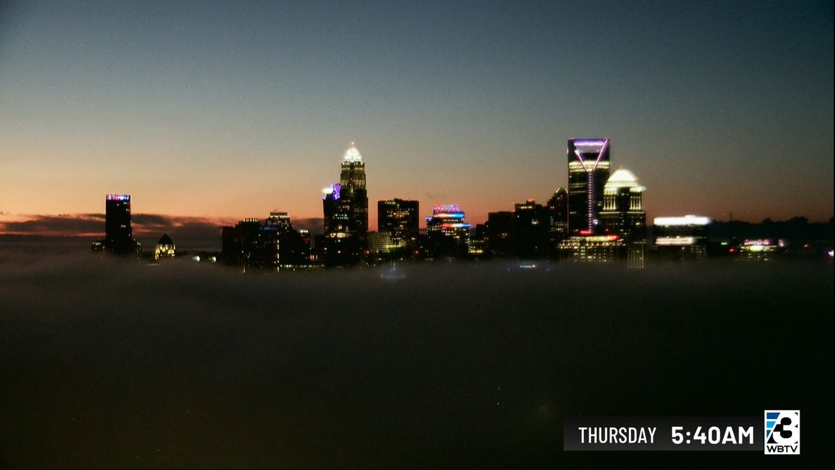
Whoa...eerie start to our Thursday! Clear skies above the @cltskyline, dense fog & low clouds at street level! Fog will burn off, MUCH better day on the way! @marykingtv @alexgilesnews @erikahammond @nwsgsp

Whoa...eerie start to our Thursday! Clear skies above the @cltskyline, dense fog & low clouds at street level! Fog will burn off, MUCH better day on the way! @marykingtv @alexgilesnews @erikahammond @nwsgsp #NCwx #SCwx #CLTwx
account_circle
Al Conklin WBTV(@AlConklin) 's Twitter Profile Photo

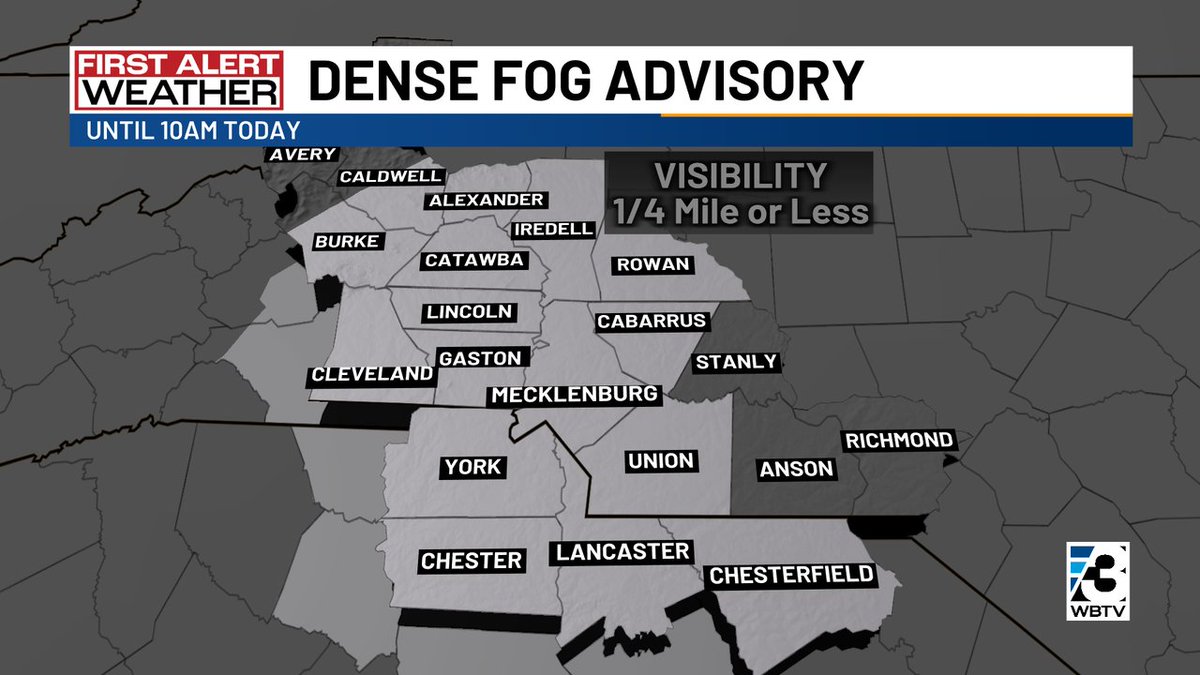
First Alert: After the very wet Wednesday, we've got dense fog around & the @wbtv_news area this morning. It will burn off mid-morning, allowing for some much-needed sunshine! Be careful on the commute this morning. wx

First Alert: After the very wet Wednesday, we've got dense fog around #CLT & the @wbtv_news area this morning. It will burn off mid-morning, allowing for some much-needed sunshine! Be careful on the commute this morning. #NCwx #SCwx #CLTwx
account_circle
Al Conklin WBTV(@AlConklin) 's Twitter Profile Photo

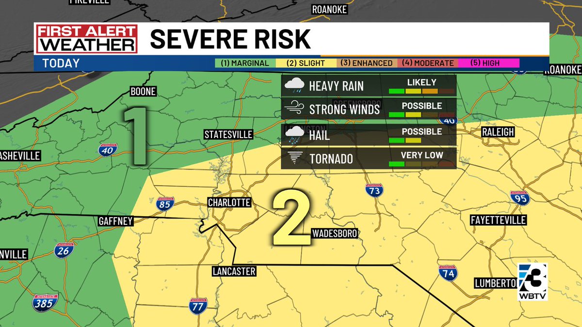
First Alert: & most of the @wbtv_news area under a level 2 of 5 concern for severe weather this afternoon / evening. Some storms will likely bring gusty winds & heavy, flooding downpours. Small hail a possibility as well. wx

First Alert: #CLT & most of the @wbtv_news area under a level 2 of 5 concern for severe weather this afternoon / evening. Some storms will likely bring gusty winds & heavy, flooding downpours. Small hail a possibility as well. #NCwx #SCwx #CLTwx
account_circle
Al Conklin WBTV(@AlConklin) 's Twitter Profile Photo

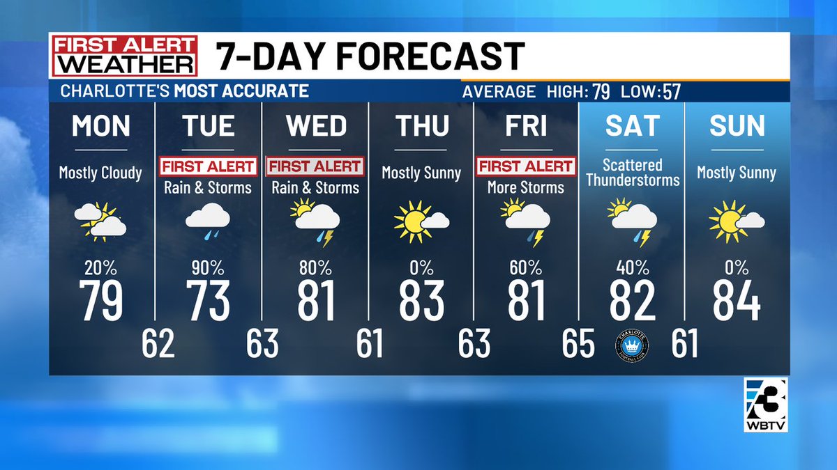
First Alerts are now in play for Tuesday, Wednesday & Friday. Rain will start tonight around the area & continues off & on Tuesday. Thunderstorm chances return late Tuesday into most of Wednesday. Thursday looks great, followed by more storms Friday. wx

First Alerts are now in play for Tuesday, Wednesday & Friday. Rain will start tonight around the #CLT area & continues off & on Tuesday. Thunderstorm chances return late Tuesday into most of Wednesday. Thursday looks great, followed by more storms Friday. #NCwx #SCwx #CLTwx
account_circle
Eric Garlick(@EricGarlickwx) 's Twitter Profile Photo

First Alert Forecast: A nice Mother's Day Ahead. First Alerts are in place for Tuesday and Wednesday. Widespread rain with thunderstorms will be likely. wx

account_circle
Dr. Tamitha Skov(@TamithaSkov) 's Twitter Profile Photo

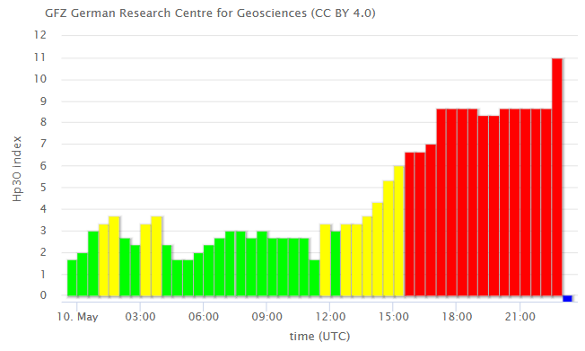
According to Hp30 (this is an index like Kp, but it averages over 30 minutes instead of 3 hours), we are in a G5 storm. Anything over '9.0' is G5-- we are at '11'. Time will tell if this has the punch to cause Kp to reach G5 as well. references duly noted.

According to Hp30 (this is an index like Kp, but it averages over 30 minutes instead of 3 hours), we are in a G5 storm. Anything over '9.0' is G5-- we are at '11'. Time will tell if this #solarstorm has the punch to cause Kp to reach G5 as well. #SpinalTap references duly noted.
account_circle
Al Conklin WBTV(@AlConklin) 's Twitter Profile Photo

The overall rain chance is lower today than it has been all week, but there's still likely to be a few thunderstorms around this afternoon/evening. The best chance appears to be in the mountains & around & neighborhoods along & S/E of I-85. wx

The overall rain chance is lower today than it has been all week, but there's still likely to be a few thunderstorms around this afternoon/evening. The best chance appears to be in the mountains & around #CLT & neighborhoods along & S/E of I-85. #NCwx #SCwx #CLTwx
account_circle
Rachel Coulter WBTV(@Coulter_wx) 's Twitter Profile Photo

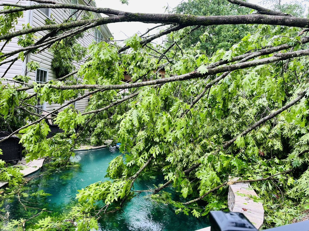
*PRELIMINARY* The NWS GSP has found damage consistent with an EF-1 tornado from Gastonia to Belmont (Gaston Co) with peak winds estimated at 110mph... Details to come! WBTV News Al Conklin WBTV Elissia Wilson

account_circle
Al Conklin WBTV(@AlConklin) 's Twitter Profile Photo

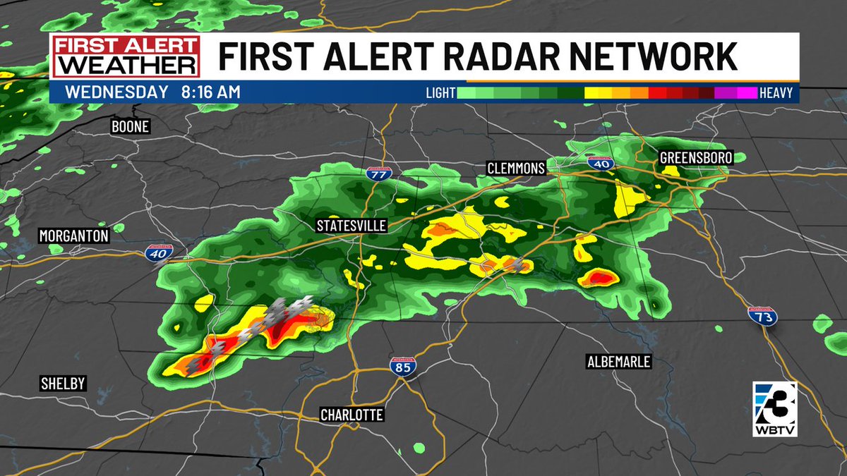
Today is a First Alert Weather Day. We will likely get at least one more round of showers & potentially heavy thunderstorms across the @wbtv_news area mid-morning thru early afternoon. Flooding is a concern! wx

Today is a First Alert Weather Day. We will likely get at least one more round of showers & potentially heavy thunderstorms across the @wbtv_news area mid-morning thru early afternoon. Flooding is a concern! #CLT #NCwx #SCwx #CLTwx
account_circle