Phos³ 🇨🇦 | ❤️ OneLoveDAO(@_phos3) 's Twitter Profileg
Phos³ 🇨🇦 | ❤️ OneLoveDAO

@_phos3

Kathryn ❤️ Dave ETH, TEZ, SOL Exhibited: New York - Miami - Beijing - Bali - Boston - TO | Kathryn mngr. of account https://t.co/zNPwt7j0bQ

ID:776754596

linkhttp://www.phos3.com calendar_today23-08-2012 21:04:15

49,2K Tweets

3,6K Followers

4,7K Following

Nathan Howes TWN(@HowesNathan) 's Twitter Profile Photo

Latest risk map for this evening/overnight. The front's timing will be critical in the severe storm chance. If cold front speeds up, the environment will be better suited for rotating storms to develop in areas near Sudbury, Manitoulin Island and Bruce Peninsula.

Latest #ONstorm risk map for this evening/overnight. The front's timing will be critical in the severe storm chance. If cold front speeds up, the environment will be better suited for rotating storms to develop in areas near Sudbury, Manitoulin Island and Bruce Peninsula. #ONwx
account_circle
Phos³ 🇨🇦 | ❤️ OneLoveDAO(@_phos3) 's Twitter Profile Photo

GM/GN friends

446 days posting our lightning and wx

So far 67 confirmed tornados today. The importance we play as storm chasers/spotters is huge ground to truth the radar

Girls Who Chase
#StormHour
EXTREMEWEATHER.CLUB
#ThePhotoHour
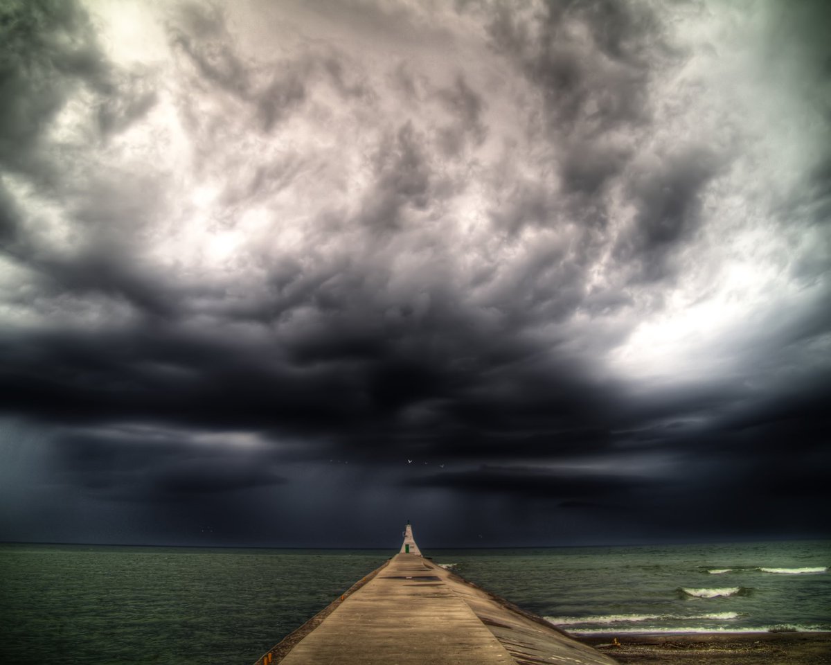
GM/GN friends 446 days posting our lightning and wx So far 67 confirmed tornados today. The importance we play as storm chasers/spotters is huge ground to truth the radar @GirlsWhoChase @StormHour @xWxClub @ThePhotoHour
account_circle
Heather Zons(@HeatherZWeather) 's Twitter Profile Photo

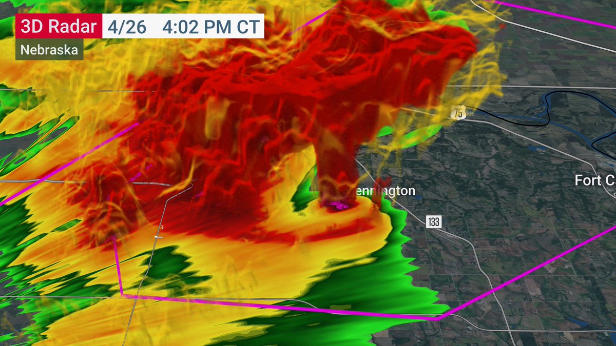
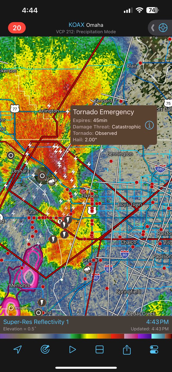
I promise you've NEVER seen a radar signature like this before 😳

This was as the tornado was passing north & west of Omaha, NE just about an hour ago

I promise you've NEVER seen a radar signature like this before 😳 This was as the tornado was passing north & west of Omaha, NE just about an hour ago
account_circle
Sam Emmerson(@ou_sams) 's Twitter Profile Photo

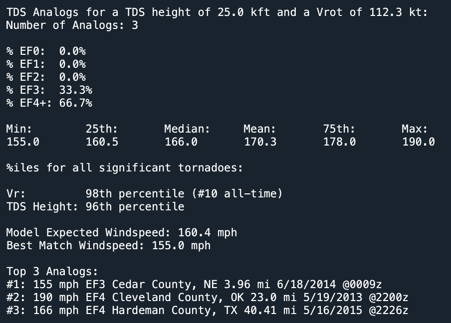
Not often that you see tornadoes with 110+ kt Vrot in a populated area, and even less often are those tornadoes any less than EF4+ intensity. The tornado that hit the western portions of Omaha earlier leaves little doubt as to how intense it truly was.

Not often that you see tornadoes with 110+ kt Vrot in a populated area, and even less often are those tornadoes any less than EF4+ intensity. The tornado that hit the western portions of Omaha earlier leaves little doubt as to how intense it truly was. #newx
account_circle
Ryan🌪️(@RyanWx_) 's Twitter Profile Photo

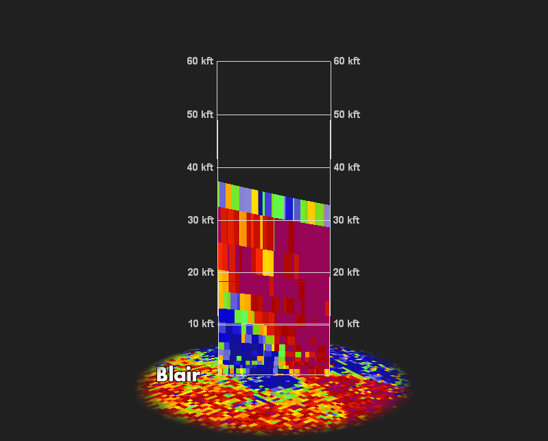
Analyzing quickly on the CC drop from the Bennington area, 10-20k (23k max) lofting height with consistent gate to gate around 170-190mph.

Incredible.

Analyzing quickly on the CC drop from the Bennington area, 10-20k (23k max) lofting height with consistent gate to gate around 170-190mph. Incredible.
account_circle
Western_Kansas_Wx(@300MphEF5) 's Twitter Profile Photo

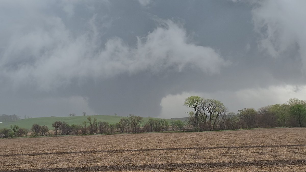
MASSIVE tornado entering west areas of Omaha Nebraska! Here’s a video of the very large wedge tornado from skycam, incredibly rapid motion!

account_circle
Phos³ 🇨🇦 | ❤️ OneLoveDAO(@_phos3) 's Twitter Profile Photo

GM/GN friends

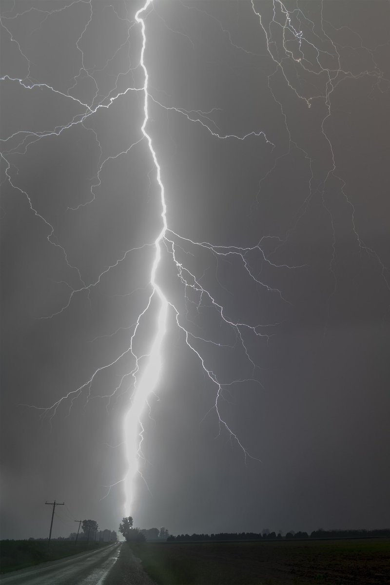
445 days posting our lightning and wx

This was a close call. Less than 1/4 mile away. So close that at 18mm Dave couldn’t get the whole bolt in frame.

Girls Who Chase
#StormHour
EXTREMEWEATHER.CLUB
#ThePhotoHour

GM/GN friends 445 days posting our lightning and wx This was a close call. Less than 1/4 mile away. So close that at 18mm Dave couldn’t get the whole bolt in frame. @GirlsWhoChase @StormHour @xWxClub @ThePhotoHour
account_circle