Segregation_by_Design
@SegByDesign
Using data & remastered historic photos to document the destruction of communities of color by redlining, urban renewal, & freeways. Also potential solutions.
ID:1463491769996169223
https://www.segregationbydesign.com/ 24-11-2021 13:04:51
919 Tweets
48,3K Followers
1,2K Following
 's Twitter Profile Photo")
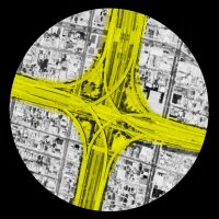
📢 New preprint: Urban highways are barriers to social ties: arxiv.org/abs/2404.11596
We overlay the highway network with a massive, geolocated online social network, and measure how social ties are impacted by highway segments in 50 US cities.
#geospatial #urbanism #segregation
 on Twitter photo 2024-04-18 11:00:24 📢 New preprint: Urban highways are barriers to social ties: arxiv.org/abs/2404.11596 We overlay the highway network with a massive, geolocated online social network, and measure how social ties are impacted by highway segments in 50 US cities. #geospatial #urbanism #segregation")
Rep. Seth Moulton Canada Adam here... this is actually a map I made for a class at Columbia GSAPP. Here is an updated version. This is not supposed to be a realistic proposal, but just to get people thinking about the possibilities of HSR.
 on Twitter photo 2024-04-11 08:33:06 @RepMoulton @Canada Adam here... this is actually a map I made for a class at @ColumbiaGSAPP. Here is an updated version. This is not supposed to be a realistic proposal, but just to get people thinking about the possibilities of HSR.")
 's Twitter Profile Photo")
🔵 youtube.com/watch?v=jENfZQ… «This project reveals, that government-led segregation is not history.» is our #Takeaway from Adam Segregation_by_Design.
#ODAD26 #OnDataAndDesign #onlineevent
#Data #Art #dataviz #infoviz #Data Visualization
 's Twitter Profile Photo")
Please follow Segregation_by_Design Segregation by Design to get real answers to these questions
 's Twitter Profile Photo")
 's Twitter Profile Photo")
Construction of I-35 through Austin, TX destroyed Black neighborhoods and divided the city. Watch the full video here: youtu.be/e5T-jnVR6Fw
This video is inspired by the amazing work of Segregation_by_Design and Smart Growth America
Video by Reconnect Austin
 's Twitter Profile Photo")
 on Twitter photo 2024-03-15 02:42:35 People rave about European cities But this is an American City c. 1900 What city is it?")
 's Twitter Profile Photo")
 on Twitter photo 2022-12-07 00:34:05 Everybody knows that rent represents a transfer of wealth that disproportionately benefits whiter, richer people. The same is true for neighborhoods– flows of rent between neighborhoods disproportionately originate in lower income, less white places and flow to rich white ones.")
 's Twitter Profile Photo")
 on Twitter photo 2022-03-13 23:06:23 In the NYC region, Housing unit growth has been strong between 1940 and 2019 in most of the city + the NJ waterfront—unsurprising given New York's resilience over the past few decades. The number of units has declined notably in parts of the South Bronx, Brownsville, & Newark.")
 's Twitter Profile Photo")
 's Twitter Profile Photo")
 's Twitter Profile Photo")
 on Twitter photo 2024-02-13 19:58:38 “We had the ‘big red’ that would go out to Pasadena, big red to San Pedro, big red to Long Beach,” remembers famed saxophonist Big Jay McNeely (1927-2018). “They ran so fast, it didn’t take you any time to get there.” More on LA transit history: segregationbydesign.com/los-angeles/tr…")
Construction of the 10 cut the Pico District in half in the 1960s, displacing over 600 families—nearly all of them Black. In the decade prior, Santa Monica had displaced hundreds more when it demolished the entirety of the nearby Belmar Triangle. More at: segregationbydesign.com/los-angeles/sa…
 's Twitter Profile Photo")
Segregation_by_Design Texas Society of Architects You might be interested this essay about 'Flipping Boy' by Leah Binkovitz.
houstonchronicle.com/opinion/outloo…