NWS Los Angeles(@NWSLosAngeles) 's Twitter Profileg
NWS Los Angeles

@NWSLosAngeles

Official Twitter account for the National Weather Service Los Angeles. Details: https://t.co/XR2JbmS8pl

ID:599632006

linkhttp://weather.gov/losangeles calendar_today04-06-2012 22:52:07

39,1K Tweets

144,7K Followers

805 Following

Follow People
NWS Los Angeles(@NWSLosAngeles) 's Twitter Profile Photo

Gusty northwest to north winds will continue through Tuesday across the mountains, Antelope Valley, and southwest Santa Barbara county, with peak gusts in the 45-55 mph range.

Gusty northwest to north winds will continue through Tuesday across the mountains, Antelope Valley, and southwest Santa Barbara county, with peak gusts in the 45-55 mph range. #Cawx #LA #SoCal
account_circle
NWS Los Angeles(@NWSLosAngeles) 's Twitter Profile Photo

Extended period of gale force wind potential with large choppy seas through much of next week for the outer waters and western portions of the Santa Barbara Channel.

Extended period of gale force wind potential with large choppy seas through much of next week for the outer waters and western portions of the Santa Barbara Channel. #cawx #Socal
account_circle
NWS Los Angeles(@NWSLosAngeles) 's Twitter Profile Photo

Gusty northwest to north winds will continue through Monday across the mountains, Antelope Valley, and southwest Santa Barbara county, with peak gusts in the 45-55 mph range.

Gusty northwest to north winds will continue through Monday across the mountains, Antelope Valley, and southwest Santa Barbara county, with peak gusts in the 45-55 mph range. #Cawx #LA #SoCal
account_circle
NWS Los Angeles(@NWSLosAngeles) 's Twitter Profile Photo

West to northwest winds will increase through the day Friday and persist into Saturday as an “inside slider” low pressure system brings increasing north flow aloft and offshore N to S pressure gradients at the surface.

West to northwest winds will increase through the day Friday and persist into Saturday as an “inside slider” low pressure system brings increasing north flow aloft and offshore N to S pressure gradients at the surface. #Cawx #LA #SoCal
account_circle
NWS Los Angeles(@NWSLosAngeles) 's Twitter Profile Photo

Do you live in the ? Don't have plans tonight? Come join us at 7:30pm at the VFW Post 3000 in Quartz Hill and learn how to become a weather spotter. Training will be provided. Thanks to the Antelope Valley Amateur Radio Club for hosting this event.

Do you live in the #AntelopeValley? Don't have plans tonight? Come join us at 7:30pm at the VFW Post 3000 in Quartz Hill and learn how to become a weather spotter. Training will be provided. Thanks to the Antelope Valley Amateur Radio Club for hosting this event. #Skywarn #CAwx
account_circle
NWS Los Angeles(@NWSLosAngeles) 's Twitter Profile Photo

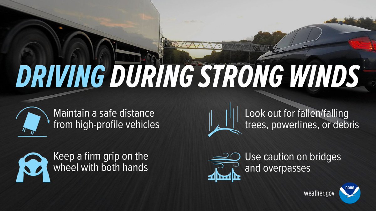
With gusty winds expected tomorrow (Friday), remember to secure any loose outdoor items, and drive with extra caution during strong winds. 🌬️🚗

With gusty winds expected tomorrow (Friday), remember to secure any loose outdoor items, and drive with extra caution during strong winds. 🌬️🚗 #CAwx #LAwind
account_circle
NWS Los Angeles(@NWSLosAngeles) 's Twitter Profile Photo

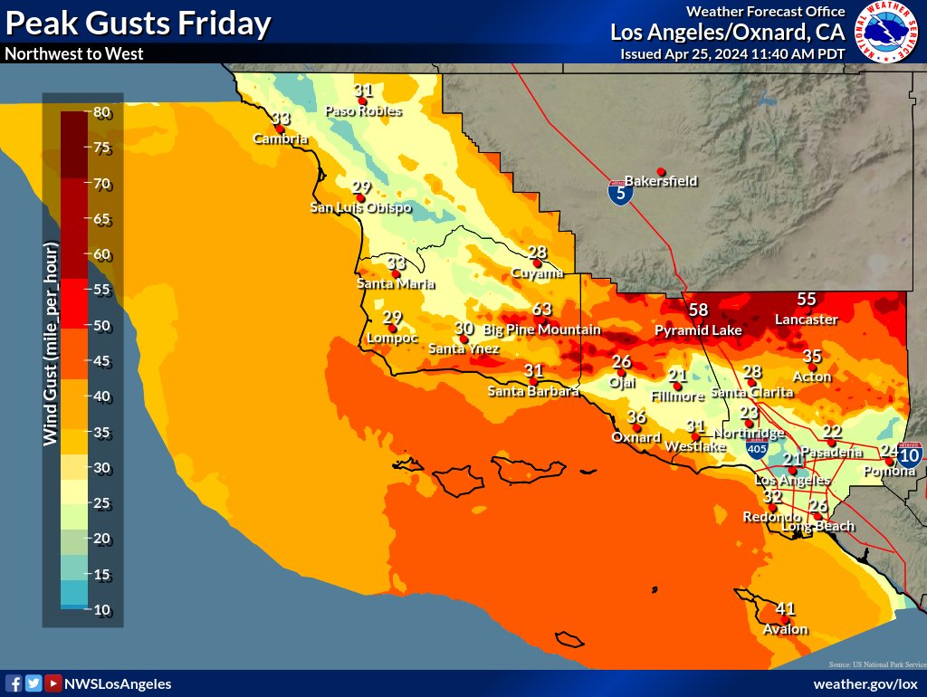
Gusty NW to W winds continue or develop across the region this afternoon and night. Winds will be the strongest for most locations tomorrow (Friday) into tomorrow night.🌬️

Gusty NW to W winds continue or develop across the region this afternoon and night. Winds will be the strongest for most locations tomorrow (Friday) into tomorrow night.🌬️ #CAwx #LAwind
account_circle
National Weather Service(@NWS) 's Twitter Profile Photo

Wildfires are caused by a spark in the presence of fuel and oxygen. Strong winds, high temperatures, low humidity and drought conditions can further impact the fire’s spread. To stay and protect yourself from wildfires, visit weather.gov/safety/wildfire

Wildfires are caused by a spark in the presence of fuel and oxygen. Strong winds, high temperatures, low humidity and drought conditions can further impact the fire’s spread. To stay #WeatherReady and protect yourself from wildfires, visit weather.gov/safety/wildfire
account_circle
NWS Los Angeles(@NWSLosAngeles) 's Twitter Profile Photo

The large earthquake off of Taiwan will NOT produce a tsunami over California. Again, NO tsunami threat exists for California.

account_circle
NWS Los Angeles(@NWSLosAngeles) 's Twitter Profile Photo

Today could be the first 90° degree of 2024 in the . The forecast calls for to hit 90° today, then cool to well below normal by the end of the week. (Photo: Pamela Heckel)

Today could be the first 90° degree of 2024 in the #AntelopeValley. The forecast calls for #Palmdale to hit 90° today, then cool to well below normal by the end of the week. #CAwx (Photo: Pamela Heckel)
account_circle
NWS Los Angeles(@NWSLosAngeles) 's Twitter Profile Photo

Patchy dense fog is being reported along the Santa Ynez River near Lompoc, Buellton, and Santa Ynez this morning. If heading out this morning, slow down. If you encounter dense fog, use low beam headlights and increase the space around your vehicle from others.

Patchy dense fog is being reported along the Santa Ynez River near Lompoc, Buellton, and Santa Ynez this morning. If heading out this morning, slow down. If you encounter dense fog, use low beam headlights and increase the space around your vehicle from others. #CAwx
account_circle
NWS Los Angeles(@NWSLosAngeles) 's Twitter Profile Photo

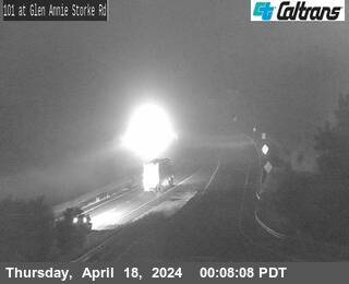
Dense fog is developing early this morn across and the coast. Slow down! Allow for more time to reach your destination. If you have a flight Santa Barbara Airport, check the latest flight arrivals/departures. Thanks to Caltrans HQ for these photos.

Dense fog is developing early this morn across #SantaBarbara and the #VenturaCounty coast. Slow down! Allow for more time to reach your destination. If you have a flight @SBAirport, check the latest flight arrivals/departures. Thanks to @CaltransHQ for these photos. #CAwx
account_circle
NWS Los Angeles(@NWSLosAngeles) 's Twitter Profile Photo

Temperatures for DTLA have been all over the place this April, with a trend of cold wet weekends. 🌧️

Happy to report that rain is NOT expected this weekend! 😎

Temperatures for DTLA have been all over the place this April, with a trend of cold wet weekends. 🌧️ Happy to report that rain is NOT expected this weekend! 😎
account_circle